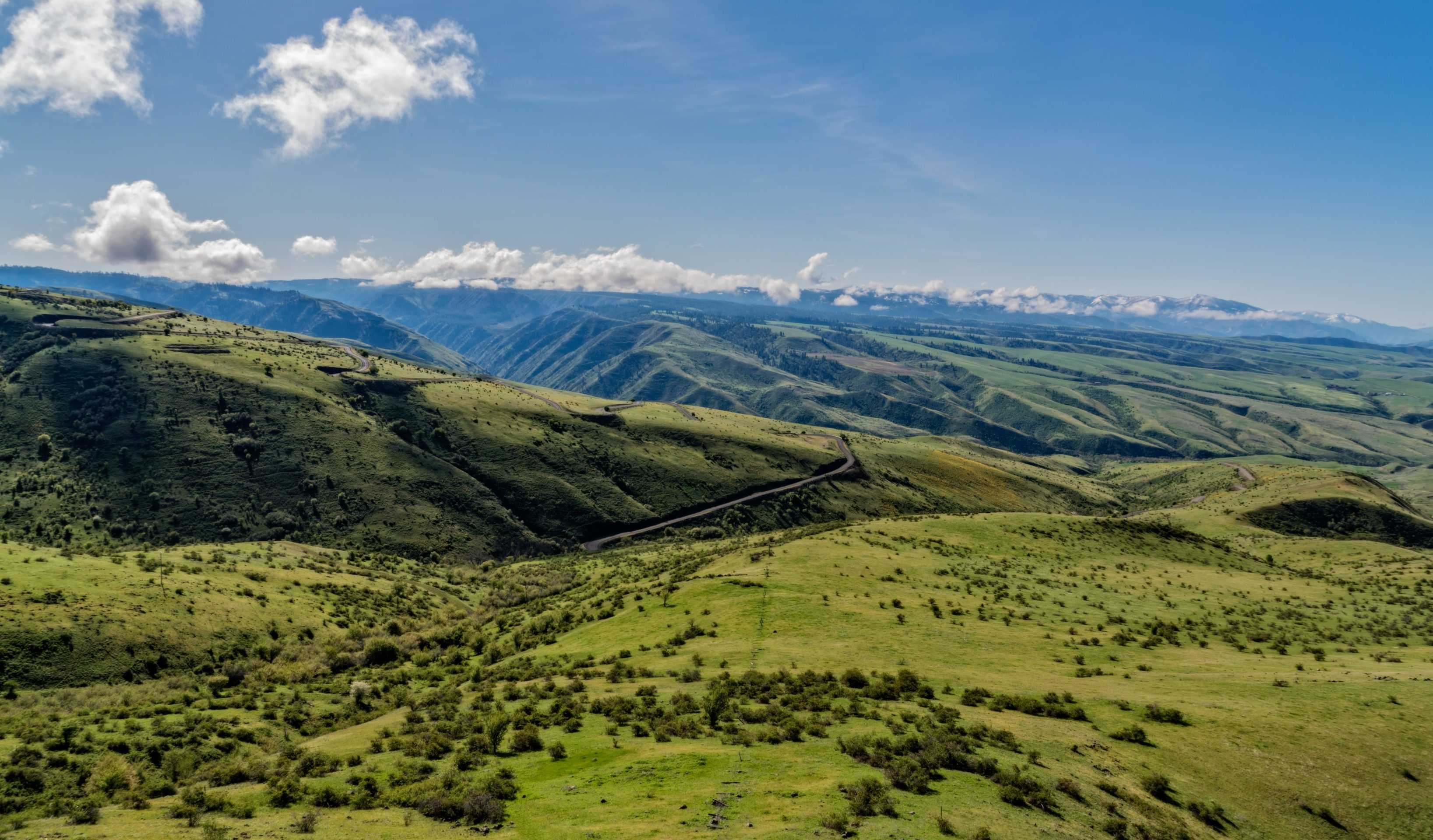
The Whitebird Grade has amazing views of the canyon nearly 3000 feet below, but it also has a lot of history. Here’s what Wikipedia says about the summit:
“White Bird Hill Summit is a mountain pass in north centralIdaho on U.S. Highway 95. Located in Idaho County, it is midway between White Bird and Grangeville. The summit elevation of the highway is 4,245 feet (1,294 m) above sea level, through a substantial cut.
The modern multi-lane highway was completed 41 years ago,[1] following ten years of construction which concluded with the opening of the bridge at the base over White Bird Creek in June 1975.[2][3][4][5][6] The treeless northbound grade climbs 2,700 feet (820 m) in 7 miles (11 km), an average gradient of over 7%.[5]
The original road was completed in 1921 and first paved in 1938, it rose slightly higher to 4,429 feet (1,350 m), due to the absence of a summit cut. Located to the east, the old road was twice the length and had a multitude of switchbacks ascending a treeless slope. On the present highway, the descent north of the summit is less dramatic as the grade drops less than 900 feet (270 m) in the forest with few curves onto theCamas Prairie towards Grangeville at 3,400 feet (1,040 m).
White Bird Hill Summit marks the divide between the Salmon River and the Camas Prairie. The Battle of White Bird Canyon of the Nez Perce War occurred in the valley south of the summit in 1877. Chief White Birdwas a respected leader of the Nez Perce tribe.”
The Nezperce War’s first battle was down in the canyon. There is a viewpoint along Highway 95 and if you venture up the old grade the battlefield is well marked and open to the public. The Nezperce bands that lived in this area were upset about being told to move to the reservation in 1877. Some of the braves killed a white rancher and then others joined in and several raids ensued. As worried settlers tried to make their way to the fort at Mount Idaho, word was sent and the army came. The army came down into the canyon where the Nezperce were waiting for them to get into an opportune spot and then dealt huge amounts of damage and death to the soldiers. The army was turned back to the fort but soon received reinforcements and chased the Nezperce across Montana having several skirmishes along the way before Chief Joseph surrendered. I have provided a very summarized account here, but many have covered it in more detail.
The springtime is so beautiful here and you can see the yellow wildflowers coloring some of the hills in many of these shots. This next picture shows the contrast of the season changing. The snowy peaks stand tall behind the lush green canyon. In early summer all of this will turn golden yellow as the grass dies.
The old Whitebird Grade is a fun road that I have driven in a car and ridden on my motorcycle. It has tons of tight turns and awesome views. In the summer they have a bicycle race up it called “Just for the hill of it.”
No matter where you stand on the historical activities that took place here. You can stand here now and appreciate the breathtaking views and dramatic landscape. See my full gallery from this trip here.
What is your favorite vista point? Comment and share below if you enjoyed this post.


